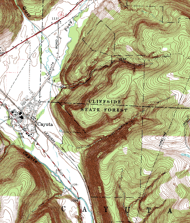
Map from http://www.topozone.com
Cliffside wins the prize as the least accessible public land in Tompkins County. There are no roads to the north. To the west, Morrell Road dead-ends short of the forest boundary (with a thicket of orange "posted signs" between the public road and the public land). A narrow strip of private land separates the state forest from NY Route 224 to the south. To the east of Cliffside is Arnot Forest, which is owned by Cornell. But you can't make the relatively direct approach via Irish Hill Road, because Cornell has closed this road indefinitely at the gate to Arnot. Instead, you have to take (Schuyler) County Route 13 (Jackson Hollow Road), which is accessible from Van Kirk Road in the north or NY Route 224 in the south. From here, a turn onto Banfield Road allows you to enter Arnot. Driving on, you eventually reach the northwestern section of this forest, where the road makes a sharp turn from northward to eastward. Here a jeep trail continues west, while the pipeline cuts through from NNE to SSW. Park at the junction and hike west for 2/3 of a mile. Along the way, you'll need to fork left where the old jeep trail veers away from a newer logging road. This isn't the first possible left - it's at a clearing where both possible forks are about equally distinct. If you can manage that, you'll soon find yourself in Cliffside State Forest (congratulations). From here, the jeep trail drops down through a section of this forest. Other trails veer off and soon hit private land, and the jeep trail itself leaves the state forest before too long. If I make it out here again, I'll try for the cliffs visible on the topo map below (this time I had forgotten the map and ran out of water on a hot day).
Map from http://www.topozone.com